Polygon - TX: Difference between revisions
From imde.io
No edit summary |
No edit summary |
||
| (2 intermediate revisions by the same user not shown) | |||
| Line 1: | Line 1: | ||
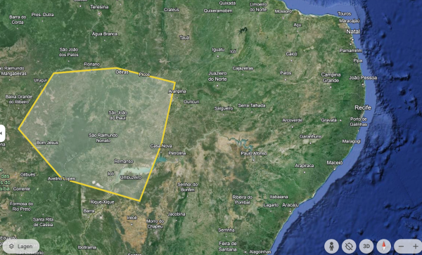
A Polygon is a shape on a map that links a number of individual grid references. A Polygon is useful for providing information or data about [[ | A Polygon is a shape on a map that links a number of individual grid references. A Polygon is useful for providing information or data about [[Primary_Materials_-_TX|primary material acquisition (PMA)]]. | ||
[[File:Polygon drawn using GoogleEarth.png|frameless|600px]] | [[File:Polygon drawn using GoogleEarth.png|frameless|600px]] | ||
Latest revision as of 08:19, 7 June 2024
A Polygon is a shape on a map that links a number of individual grid references. A Polygon is useful for providing information or data about primary material acquisition (PMA).
Polygons are defined by a set of by latitude and longitude coordinates, in the order the shape should be drawn, where the last coordinate is the same as the first. Below an example:
[0.731300,46.605612 -0.191250,46.704963 -0.191250,46.846894 0.177770,46.988824 0.447438,46.960438 0.589369,46.804315 0.688721,46.832701 0.731300,46.605612 0.731300,46.605612]
You can draw polygons and export them as KML files using Google Earth
